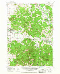
1950 Map of Brownsville
USGS Topo · Published 1967About this map
Brownsville sits at the transition from the Willamette Valley floor to the rising foothills, serving as a hub for the surrounding timber and agricultural lands during the mid-century era. The Calapooia River and its various tributaries like Courtney Creek and Oak Creek define the drainage of the southern valley, while the Santiam River cuts across the northern reaches near Waterloo. This landscape is marked by prominent topographic features such as Lone Pine Butte and Bald Peter, which rise sharply above the river bottoms. The infrastructure of the period is evidenced by the Oregon Electric line and a network of rural schoolhouses and churches that anchored these small communities, including the Beulahland School and the Berlin Union Ch. Local industries are represented by several quarries and gravel pits, while small settlements like Crawfordsville and Sodaville indicate the established residential patterns of Linn County.
Find a feature on this map
53 named features on this map. Tap any name to fly to it.
Don’t see what you’re looking for? This feature index may not catch every label — zoom into the map to look around manually.
Map Details
Editions of this 1950 Brownsville Map
3 editions found

Other maps of this area

1909 · Rowland
USGS Topo · 1:31,680

1910 · Eugene
USGS Topo · 1:62,500

1911 · Brownsville
USGS Topo · 1:31,680

1911 · Lebanon
USGS Topo · 1:31,680

1911 · Tangent
USGS Topo · 1:31,680

1912 · Halsey
USGS Topo · 1:62,500

1916 · Albany
USGS Topo · 1:62,500

1921 · Brownsville
USGS Topo · 1:62,500

1921 · Lebanon
USGS Topo · 1:62,500

1922 · Lebanon
USGS Topo · 1:48,000