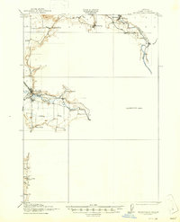
1921 Map of Brownsville
USGS Topo · Published 1947About this map
Brownsville serves as a primary hub for this early 20th-century landscape, situated where the Southern Pacific railroad meets the winding Calapooya River. The map reveals a highly developed network of rural education, with numerous local institutions like Union Point School, Rockhill School, and Diamond Hill School serving the farming families of the southern Willamette Valley. Infrastructure like the Brownsville Ditch and the proximity of settlements such as Sodaville and Waterloo reflect an era of established agriculture and hydraulic management.
Find a feature on this map
32 named features on this map. Tap any name to fly to it.
Don’t see what you’re looking for? This feature index may not catch every label — zoom into the map to look around manually.
Map Details
Editions of this 1921 Brownsville Map
4 editions found
Other maps of this area

1909 · Rowland
USGS Topo · 1:31,680

1910 · Eugene
USGS Topo · 1:62,500

1911 · Brownsville
USGS Topo · 1:31,680

1911 · Lebanon
USGS Topo · 1:31,680

1911 · Tangent
USGS Topo · 1:31,680

1912 · Halsey
USGS Topo · 1:62,500

1916 · Albany
USGS Topo · 1:62,500

1921 · Brownsville
USGS Topo · 1:62,500

1921 · Lebanon
USGS Topo · 1:62,500

1922 · Lebanon
USGS Topo · 1:48,000