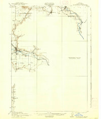
1921 Map of Brownsville
USGS Topo · Published 1938About this map
Brownsville and the surrounding Willamette Valley foothills are documented here during the early twentieth century, showing a landscape defined by water and rail. The Southern Pacific railroad runs through the heart of the settlement, while the Brownsville Ditch diverts water from Calapooya Creek for local use. To the north, the small communities of Sodaville and Waterloo sit near the South Santiam River, highlighting the importance of river systems in early Oregon transport and industry.
Find a feature on this map
25 named features on this map. Tap any name to fly to it.
Don’t see what you’re looking for? This feature index may not catch every label — zoom into the map to look around manually.
Map Details
Editions of this 1921 Brownsville Map
4 editions found
Other maps of this area

1909 · Rowland
USGS Topo · 1:31,680

1910 · Eugene
USGS Topo · 1:62,500

1911 · Brownsville
USGS Topo · 1:31,680

1911 · Lebanon
USGS Topo · 1:31,680

1911 · Tangent
USGS Topo · 1:31,680

1912 · Halsey
USGS Topo · 1:62,500

1916 · Albany
USGS Topo · 1:62,500

1921 · Brownsville
USGS Topo · 1:62,500

1921 · Lebanon
USGS Topo · 1:62,500

1922 · Lebanon
USGS Topo · 1:48,000