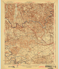
1923 Map of Brownsville
USGS Topo · Published 1942About this map
The Green River and Barren River dominate this 1920s topography, winding through the complex terrain of Warren, Edmonson, and Butler counties. During this era, the river systems remained vital corridors for commerce and travel, evidenced by numerous river crossings and navigational aids such as Davis Ferry, Pittsburg Landing, and Lock No 6. The landscape is dotted with rural centers like Richardsville and Sand Hill, while the more developed southern portion showcases the influence of the Louisville and Nashville railroad on the growth of Bowling Green.
Find a feature on this map
81 named features on this map. Tap any name to fly to it.
Don’t see what you’re looking for? This feature index may not catch every label — zoom into the map to look around manually.
Map Details
Editions of this 1923 Brownsville Map
3 editions found
Other maps of this area

1914 · Little Muddy
USGS Topo · 1:62,500

1921 · Bowling Green
USGS Topo · 1:62,500

1922 · Leitchfield
USGS Topo · 1:48,000

1922 · Brownsville
USGS Topo · 1:62,500

1922 · Mammoth Cave
USGS Topo · 1:62,500

1923 · Bowling Green
USGS Topo · 1:62,500

1923 · Mammoth Cave
USGS Topo · 1:62,500

1923 · Brownsville
USGS Topo · 1:62,500

1925 · Spring Lick
USGS Topo · 1:62,500

1925 · Cub Run
USGS Topo · 1:62,500