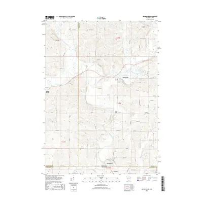
2016 Map of Browntown
USGS Topo · Published 2016About this map
The Pecatonica River winds through this borderland topography, carving a wide valley that defines the landscape between Lafayette and Green counties in Wisconsin and Stephenson County in Illinois. Small agricultural hubs like South Wayne, Browntown, and Martintown are linked by a network of rural roads such as Co Hwy B and Co Rd M, reflecting the region's enduring farming character. The presence of several family and community burial grounds, including Union Cem, La Due Cem, and Saucerman Cem, provides a map for genealogists tracing local lineage.
Find a feature on this map
80 named features on this map. Tap any name to fly to it.
Don’t see what you’re looking for? This feature index may not catch every label — zoom into the map to look around manually.
Map Details
Editions of this 2016 Browntown Map
This is the sole edition of this map. No revisions or reprints were ever made.
Other maps of this area

1920 · Monroe
USGS Topo · 1:62,500

1922 · Monroe
USGS Topo · 1:62,500

1923 · South Wayne
USGS Topo · 1:62,500

1937 · Lena
USGS Topo · 1:48,000

1939 · Freeport
USGS Topo · 1:48,000

1942 · Lena
USGS Topo · 1:62,500

1943 · Lena
USGS Topo · 1:62,500

1944 · Freeport
USGS Topo · 1:62,500

1954 · Rockford
USGS Topo · 1:250,000

1955 · Rockford
USGS Topo · 1:250,000