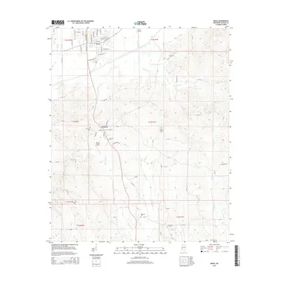
2015 Map of Bruce
USGS Topo · Published 2015About this map
Bruce and Pittsboro anchor this survey of Calhoun County, Mississippi, showing the region's development along a network of creek bottoms and low ridges. The town of Bruce is mapped in detail, featuring its street grid and the Industrial Park Rd sector, while Pittsboro remains a primary junction to the south near the Calhoun County Airport. The landscape is defined by the Skuna River and its many tributaries, including Hurricane Cr and Thompsons Cr, which create a complex drainage pattern throughout the quadrangle. For genealogists, the map is particularly useful for its documentation of numerous burial sites, ranging from the Old Town Cem in the north to Macedonia Cem and Oak Springs Cem further south. These sites, often located near local roads like Old Town Rd and CR-410, offer a detailed look at the settlement history of the rural areas between the two main towns.
Find a feature on this map
93 named features on this map. Tap any name to fly to it.
Don’t see what you’re looking for? This feature index may not catch every label — zoom into the map to look around manually.
Map Details
Editions of this 2015 Bruce Map
This is the sole edition of this map. No revisions or reprints were ever made.
Other maps of this area

1953 · West Point
USGS Topo · 1:250,000

1954 · Pittsboro
USGS Topo · 1:62,500

1956 · Tupelo
USGS Topo · 1:250,000

1958 · Tupelo
USGS Topo · 1:250,000

1958 · West Point
USGS Topo · 1:250,000

1963 · West Point
USGS Topo · 1:250,000

1972 · Robbs
USGS Topo · 1:24,000

1972 · Atlanta
USGS Topo · 1:24,000
1972 · Banner
USGS Topo · 1:24,000

1972 · Vardaman
USGS Topo · 1:24,000