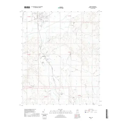
2018 Map of Bruce
USGS Topo · Published 2018About this map
Bruce and Pittsboro anchor this 2018 topographic survey of central Calhoun County, where the Skuna River meanders across a landscape defined by its creek-fed bottomlands and low ridges. The town of Bruce displays a dense grid of streets including W Calhoun St and N Pontotoc Rd, while the smaller settlement of Pittsboro lies just to the south. The area's genealogical value is high, with numerous family and community burial grounds scattered throughout the hills, such as Gaston Springs Cem, Old Town Cem, and Macedonia Cem. The Calhoun County Airport provides a modern landmark among the traditional rural features. Numerous waterways like Hurricane Cr, Duncan Cr, and Thompsons Cr create a complex drainage network that has historically dictated the placement of roads and homesteads throughout the region.
Find a feature on this map
91 named features on this map. Tap any name to fly to it.
Don’t see what you’re looking for? This feature index may not catch every label — zoom into the map to look around manually.
Map Details
Editions of this 2018 Bruce Map
This is the sole edition of this map. No revisions or reprints were ever made.
Other maps of this area

1953 · West Point
USGS Topo · 1:250,000

1954 · Pittsboro
USGS Topo · 1:62,500

1956 · Tupelo
USGS Topo · 1:250,000

1958 · Tupelo
USGS Topo · 1:250,000

1958 · West Point
USGS Topo · 1:250,000

1963 · West Point
USGS Topo · 1:250,000

1972 · Robbs
USGS Topo · 1:24,000

1972 · Atlanta
USGS Topo · 1:24,000
1972 · Banner
USGS Topo · 1:24,000

1972 · Vardaman
USGS Topo · 1:24,000