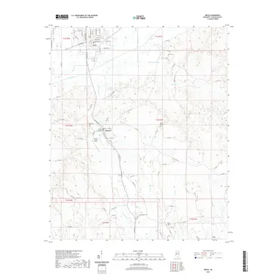
2020 Map of Bruce
USGS Topo · Published 2020About this map
The Skuna River valley forms the geographic heart of this North Mississippi landscape, where the town of Bruce and the county seat at Pittsboro anchor the local community. Significant civic and historical landmarks are concentrated in the central corridor, including the Calhoun County Courthouse and the nearby Calhoun County Airport. The settlement pattern follows the high ground between numerous tributaries like Hurricane Cr and Thompsons Cr, with local transit defined by an established network of county roads such as Armstrong Rd and N Pontotoc Rd.
Find a feature on this map
95 named features on this map. Tap any name to fly to it.
Don’t see what you’re looking for? This feature index may not catch every label — zoom into the map to look around manually.
Map Details
Editions of this 2020 Bruce Map
This is the sole edition of this map. No revisions or reprints were ever made.
Other maps of this area

1953 · West Point
USGS Topo · 1:250,000

1954 · Pittsboro
USGS Topo · 1:62,500

1956 · Tupelo
USGS Topo · 1:250,000

1958 · Tupelo
USGS Topo · 1:250,000

1958 · West Point
USGS Topo · 1:250,000

1963 · West Point
USGS Topo · 1:250,000

1972 · Robbs
USGS Topo · 1:24,000

1972 · Atlanta
USGS Topo · 1:24,000
1972 · Banner
USGS Topo · 1:24,000

1972 · Vardaman
USGS Topo · 1:24,000