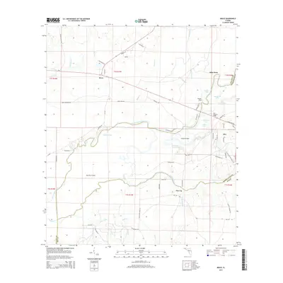
2015 Map of Bruce
USGS Topo · Published 2015About this map
Choctawhatchee River winding and braided channels define this portion of the Florida Panhandle, creating a complex network of waterways like East River and Boston Cutoff. The landscape is a mosaic of low-lying islands such as East River Island and Cowford Island, interspersed with numerous named lakes including Crews Lake and Stealing Lake. Settlement is concentrated along the higher ground and major road corridors, with Bruce in the north and Ebro to the east, while Pine Log sits further south near the confluence of Pine Log Creek and Threemile Br. Local history is embedded in the road names, from Old Gristmill Rd to Gunlock Cemetery Rd, reflecting the rural industrial and commemorative markers of the region. The Florida National Scenic Trail traverses the eastern side, highlighting the area's importance for modern recreation alongside traditional river-bound landmarks like Howell Bluff.
Find a feature on this map
75 named features on this map. Tap any name to fly to it.
Don’t see what you’re looking for? This feature index may not catch every label — zoom into the map to look around manually.
Map Details
Editions of this 2015 Bruce Map
This is the sole edition of this map. No revisions or reprints were ever made.
Other maps of this area

1935 · De Funiak Springs
USGS Topo · 1:48,000

1936 · Point Washington
USGS Topo · 1:48,000

1938 · De Funiak Springs
USGS Topo · 1:62,500

1939 · Point Washington
USGS Topo · 1:62,500

1943 · Seminole Hills
USGS Topo · 1:24,000

1943 · West Bay
USGS Topo · 1:24,000

1944 · Seminole Hills
USGS Topo · 1:31,680

1944 · West Bay
USGS Topo · 1:31,680

1944 · Bruce
USGS Topo · 1:24,000

1945 · Red Head
USGS Topo · 1:31,680