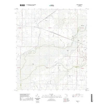
2021 Map of Bruce
USGS Topo · Published 2021About this map
The Choctawhatchee River winds through a complex network of wetlands and islands in this recent survey of the Florida panhandle. This riparian corridor is defined by features like Cowford Island and East River Island, flanked by the expansive Dismal Swamp and Titi Swamp. Small communities like Bruce and Ebro anchor the higher ground, while the settlement of Pine Log sits near the southern edge of the quadrangle. Cultural and conservation efforts are evident in the sprawling Nokuse Plantation Conservation Easement and the Pine Log State Forest Trail, reflecting a landscape dedicated to ecological preservation. Genealogists and local historians can find named routes such as Gum Lock Cemetary Rd and landmarks like the Olan Ferguson Bridge, which provide specific points of reference for tracing family connections to the river-dependent economies of Washington and Walton Counties.
Find a feature on this map
84 named features on this map. Tap any name to fly to it.
Don’t see what you’re looking for? This feature index may not catch every label — zoom into the map to look around manually.
Map Details
Editions of this 2021 Bruce Map
This is the sole edition of this map. No revisions or reprints were ever made.
Other maps of this area

1935 · De Funiak Springs
USGS Topo · 1:48,000

1936 · Point Washington
USGS Topo · 1:48,000

1938 · De Funiak Springs
USGS Topo · 1:62,500

1939 · Point Washington
USGS Topo · 1:62,500

1943 · Seminole Hills
USGS Topo · 1:24,000

1943 · West Bay
USGS Topo · 1:24,000

1944 · Seminole Hills
USGS Topo · 1:31,680

1944 · West Bay
USGS Topo · 1:31,680

1944 · Bruce
USGS Topo · 1:24,000

1945 · Red Head
USGS Topo · 1:31,680