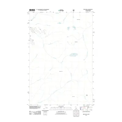
2011 Map of Bruin Hill
USGS Topo · Published 2011About this map
Bruin Hill and Bruin Ridge dominate the southern landscape of this Idaho-Montana border region, which is defined by a high-altitude drainage system and primitive road network. The terrain is characterized by numerous glacial features and basins, including the high waters of Fish Lake and the Siamese Lakes near the northern boundary. Historically, this area is a network of watercourses and crossings, with Chilcoot Pass providing a vital transit point between watersheds. The complex hydrography is anchored by the West Fork Fish Creek and Little Moose Creek, which drain the ridges and basins like Foley Basin. This 2011 survey details the land as it remained in the early 21st century, largely undeveloped and focused on natural landmarks like Wapito Point and Steep Lakes.
Find a feature on this map
22 named features on this map. Tap any name to fly to it.
Don’t see what you’re looking for? This feature index may not catch every label — zoom into the map to look around manually.
Map Details
Editions of this 2011 Bruin Hill Map
This is the sole edition of this map. No revisions or reprints were ever made.
Other maps of this area

1911 · Lolo
USGS Topo · 1:250,000

1913 · Lolo
USGS Topo · 1:250,000

1956 · Hamilton
USGS Topo · 1:250,000

1959 · Hamilton
USGS Topo · 1:250,000

1960 · Hamilton
USGS Topo · 1:250,000

1960 · Straight Peak
USGS Topo · 1:62,500

1964 · Hamilton
USGS Topo · 1:250,000
1965 · Hoodoo Pass
USGS Topo · 1:24,000

1965 · Osier Ridge
USGS Topo · 1:24,000

1965 · Gorman Hill
USGS Topo · 1:24,000