
1965 Map of Osier Ridge
USGS Topo · Published 1967About this map
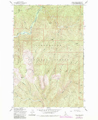
Moose City (Site) sits at the confluence of several drainages in the rugged interior of the Clearwater National Forest, representing a remote outpost in Idaho’s wilderness during the mid-1960s. The landscape is defined by its deep vertical relief, where high points like Pollock Hill and the Osier Ridge Lookout Tower provided vantage points over the dense timberlands. The North Fork Clearwater River cuts through the northern portion of the quadrangle near The Cedars, fed by a network of steep-banked tributaries including Deception Gulch and China Creek.
Find a feature on this map
37 named features on this map. Tap any name to fly to it.
Don’t see what you’re looking for? This feature index may not catch every label — zoom into the map to look around manually.
Map Details
Editions of this 1965 Osier Ridge Map
2 editions found
Other maps of this area

1911 · Lolo
USGS Topo · 1:250,000

1913 · Lolo
USGS Topo · 1:250,000

1956 · Hamilton
USGS Topo · 1:250,000

1959 · Hamilton
USGS Topo · 1:250,000

1960 · Hamilton
USGS Topo · 1:250,000

1960 · Straight Peak
USGS Topo · 1:62,500

1964 · Hamilton
USGS Topo · 1:250,000
1965 · Hoodoo Pass
USGS Topo · 1:24,000
1965 · Moose Mtn
USGS Topo · 1:24,000

1965 · Scurvy Mtn.
USGS Topo · 1:24,000