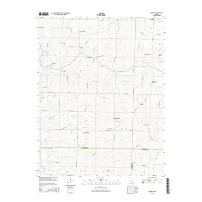
2015 Map of Brumley
USGS Topo · Published 2015About this map
Brumley and its neighboring rural settlements are situated amidst the complex terrain where Miller, Camden, and Pulaski counties meet. This 2015 survey highlights a landscape of ridges and hollows, where local life follows the drainages of Mill Cr, Brumley Cr, and the Barren Fork. Small communities like Keethtown, Samtown, and Faith are connected by a network of county roads, including CO Road 42-12 and the Brushy Branch Cutt Off. For genealogists, the Hawkins Cemetery serves as a vital focal point near Brushy Fork, while prominent landmarks like Pemberton Ridge and Shahan Ridge define the local topography. The map illustrates a contemporary rural environment where historic place names such as Hawkeye and Watkins persist alongside a modern infrastructure of power lines and secondary highways.
Find a feature on this map
84 named features on this map. Tap any name to fly to it.
Don’t see what you’re looking for? This feature index may not catch every label — zoom into the map to look around manually.
Map Details
Editions of this 2015 Brumley Map
This is the sole edition of this map. No revisions or reprints were ever made.
Other maps of this area

1888 · Versailles
USGS Topo · 1:125,000

1888 · Tuscumbia
USGS Topo · 1:125,000

1893 · Versailles
USGS Topo · 1:125,000

1894 · Tuscumbia
USGS Topo · 1:125,000

1932 · Versailles No 4
USGS Topo · 1:48,000

1933 · Stoutland
USGS Topo · 1:62,500

1933 · Iberia
USGS Topo · 1:62,500

1934 · Toronto
USGS Topo · 1:24,000

1934 · Bagnell
USGS Topo · 1:24,000

1937 · Iberia
USGS Topo · 1:62,500