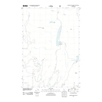
2011 Map of Brundage Mountain
USGS Topo · Published 2011About this map
Granite Mountain Lookout stands as a primary high-ground landmark in this Idaho landscape, overlooking a complex network of alpine lakes and managed water resources. The terrain is defined by a series of significant water control structures including Twin Granite Dam, Goose Lake Dam, and Brundage Dam, which regulate the flow of creeks through high-elevation valleys. Recreation and back-country access are evident at Grouse Campground, situated along Goose Lake Rd near the shores of Goose Lake. The mapping of smaller features like Last Chance Spring and the Campbell Ditch provides insight into the local water management and movement patterns required for land use in this part of Idaho County. Named peaks like Slab Butte and Brundage Mountain anchor the topography, while a network of service roads such as Hazard Lake Rd and Fisher Creek Rd connects these remote summits.
Find a feature on this map
34 named features on this map. Tap any name to fly to it.
Don’t see what you’re looking for? This feature index may not catch every label — zoom into the map to look around manually.
Map Details
Editions of this 2011 Brundage Mountain Map
This is the sole edition of this map. No revisions or reprints were ever made.
Other maps of this area

1911 · Meadows
USGS Topo · 1:125,000

1938 · Riggins
USGS Topo · 1:96,000

1945 · Riggins
USGS Topo · 1:125,000

1954 · New Meadows
USGS Topo · 1:62,500

1955 · Baker
USGS Topo · 1:250,000

1955 · Grangeville
USGS Topo · 1:250,000

1959 · Baker
USGS Topo · 1:250,000

1959 · Grangeville
USGS Topo · 1:250,000

1963 · Bally Mountain
USGS Topo · 1:24,000

1963 · Indian Mountain
USGS Topo · 1:24,000