
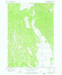
1963 Map of Bally Mountain
USGS Topo · Published 1964About this map
The Little Salmon River carves a central corridor through this 1963 survey, serving as the primary geographic axis between Adams and Idaho counties. The landscape transitions from the wooded slopes of the Payette National Forest into the open expanses of Meadows Valley. This area shows a pattern of ranching and early thermal recreation, notably at Hot Springs south of the river bend. To the east, the Circle C Ranch sits at the base of the ridges near Sixmile Creek, while small stopping points like Litter and Martin are positioned along the valley floor. High-elevation features like Bally Mountain and the Round Valley basin highlight the varied topography that defined the local economy of timber and grazing during the early 1960s.
Find a feature on this map
23 named features on this map. Tap any name to fly to it.
Don’t see what you’re looking for? This feature index may not catch every label — zoom into the map to look around manually.
Map Details
Editions of this 1963 Bally Mountain Map
2 editions found
Other maps of this area

1911 · Meadows
USGS Topo · 1:125,000

1938 · Riggins
USGS Topo · 1:96,000

1945 · Riggins
USGS Topo · 1:125,000

1954 · New Meadows
USGS Topo · 1:62,500

1955 · Baker
USGS Topo · 1:250,000

1955 · Grangeville
USGS Topo · 1:250,000

1959 · Baker
USGS Topo · 1:250,000

1959 · Grangeville
USGS Topo · 1:250,000

1963 · Indian Mountain
USGS Topo · 1:24,000
1963 · Railroad Saddle
USGS Topo · 1:24,000