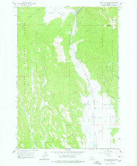
1963 Map of Bally Mountain
USGS Topo · Published 1978About this map
The Little Salmon River carves through this high-country terrain on the border of Adams and Idaho counties, anchoring a landscape of forest and valley as it appeared in the early 1960s. Much of the western half is dominated by the Payette National Forest, where a network of jeep trails and footpaths wind through drainage systems like Mud Creek and Round Valley Creek. In the eastern lowlands, Little Meadows Valley provides a level break in the topography, supporting local holdings such as the Circle C Ranch. Natural thermal activity is noted at Hot Springs along the riverbanks, while the presence of a Gravel Pit and Brown Creek Road indicates the early industrial and transit footprints of the era. The namesake Bally Mountain towers over the northeast corner, serving as a prominent landmark for the surrounding wilderness.
Find a feature on this map
19 named features on this map. Tap any name to fly to it.
Don’t see what you’re looking for? This feature index may not catch every label — zoom into the map to look around manually.
Map Details
Editions of this 1963 Bally Mountain Map
2 editions found
Other maps of this area

1911 · Meadows
USGS Topo · 1:125,000

1938 · Riggins
USGS Topo · 1:96,000

1945 · Riggins
USGS Topo · 1:125,000

1954 · New Meadows
USGS Topo · 1:62,500

1955 · Baker
USGS Topo · 1:250,000

1955 · Grangeville
USGS Topo · 1:250,000

1959 · Baker
USGS Topo · 1:250,000

1959 · Grangeville
USGS Topo · 1:250,000

1963 · Bally Mountain
USGS Topo · 1:24,000

1963 · Indian Mountain
USGS Topo · 1:24,000