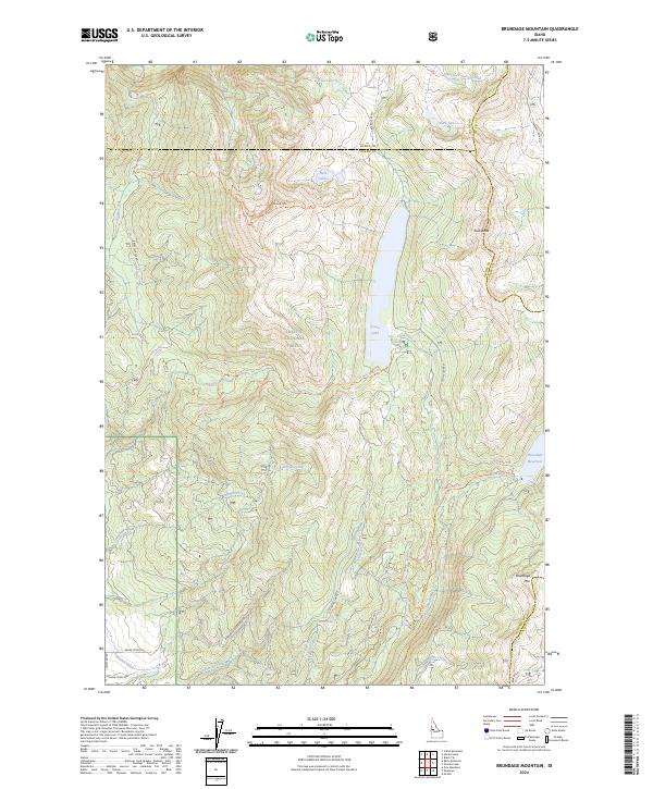
2024 Map of Brundage Mountain
USGS Topo · Published 2024About this map
Payette National Forest dominates this section of the Idaho backcountry, where the high-altitude terrain is defined by a series of prominent peaks and alpine water systems. The landscape is anchored by Granite Mountain and Brundage Mtn, providing a look at the topography used for modern recreation and resource management. Significant water features such as Goose Lake and the Brundage Reservoir illustrate the drainage patterns of Goose Creek and Brundage Creek, while the Campbell Ditch in the southwest corner indicates historical water diversion efforts. A network of Forest Service routes, including the Granite Mountain Trl and Six Mile Creek Trl, navigate the complex borders where Idaho, Adams, and Valley counties meet. Remote landmarks like Last Chance Spring and Slab Butte provide specific points of interest for those tracing the geographic history of these mountains.
Find a feature on this map
38 named features on this map. Tap any name to fly to it.
Don’t see what you’re looking for? This feature index may not catch every label — zoom into the map to look around manually.
Map Details
Editions of this 2024 Brundage Mountain Map
This is the sole edition of this map. No revisions or reprints were ever made.
Other maps of this area

1911 · Meadows
USGS Topo · 1:125,000

1938 · Riggins
USGS Topo · 1:96,000

1945 · Riggins
USGS Topo · 1:125,000

1954 · New Meadows
USGS Topo · 1:62,500

1955 · Baker
USGS Topo · 1:250,000

1955 · Grangeville
USGS Topo · 1:250,000

1959 · Baker
USGS Topo · 1:250,000

1959 · Grangeville
USGS Topo · 1:250,000

1963 · Bally Mountain
USGS Topo · 1:24,000

1963 · Indian Mountain
USGS Topo · 1:24,000