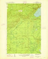
1948 Map of Bruneau Creek
USGS Topo · Published 1948About this map
Mt Horace Greeley dominates the northern reaches of this mid-century survey, looking out over the shoreline where Lake Superior meets the coast at Easter Creek. This portion of the Keweenaw Peninsula is defined by a dense network of waterways that trace through the townships of Houghton, Keweenaw, and Sherman. The drainage patterns suggest a complex landscape of low-lying wetlands and forests, particularly where Bruneau Creek and the Tobacco River converge with smaller tributaries like Snake Creek and Black Creek. While predominantly natural, the map reveals the late 1940s road network, including the path toward Eagle Harbor, indicating how these isolated interior lands were accessed for timber or local transit before modern development.
Find a feature on this map
12 named features on this map. Tap any name to fly to it.
Don’t see what you’re looking for? This feature index may not catch every label — zoom into the map to look around manually.
Map Details
Editions of this 1948 Bruneau Creek Map
2 editions found
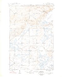
Other maps of this area

1938 · Bruneau Creek
USGS Topo · 1:31,680

1938 · Gay
USGS Topo · 1:31,680

1938 · Delaware
USGS Topo · 1:31,680

1939 · Deer Lake
USGS Topo · 1:31,680

1939 · Delaware
USGS Topo · 1:31,680

1940 · Deer Lake
USGS Topo · 1:31,680

1940 · Central
USGS Topo · 1:31,680

1941 · Mohawk
USGS Topo · 1:31,680

1946 · Phoenix
USGS Topo · 1:24,000

1946 · Bruneau Creek
USGS Topo · 1:24,000
Featured Places
- Houghton Township, MI
- Eagle Harbor Township, MI
- Sherman Township, MI
- Gratiot Lake Beach, MI
- Keweenaw County, MI