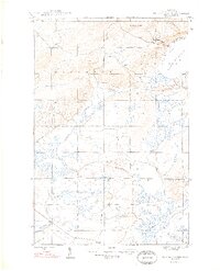
1948 Map of Bruneau Creek
USGS Topo · Published 1948About this map
Mt Horace Greeley stands as the dominant topographical feature in this northern reach of the Keweenaw Peninsula, rising above a landscape defined by its intricate drainage systems. The survey area, mapped just after the war in 1946, captures the transition from the high ridges down to the rocky shoreline of Lake Superior in the northeast. The interior is characterized by a dense network of watercourses, including the westward-flowing Tobacco River and the winding path of Bruneau Creek. These waterways, along with the Traverse River to the south, were historically central to the timber and mining logistics of the Upper Peninsula. The boundary between Houghton and Sherman townships bisects the map, illustrating the early administrative divisions of this remote timberland before modern development significantly altered the forest cover.
Find a feature on this map
13 named features on this map. Tap any name to fly to it.
Don’t see what you’re looking for? This feature index may not catch every label — zoom into the map to look around manually.
Map Details
Editions of this 1948 Bruneau Creek Map
2 editions found
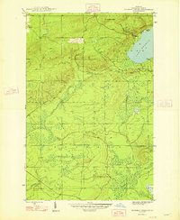
Other maps of this area

1938 · Bruneau Creek
USGS Topo · 1:31,680

1938 · Gay
USGS Topo · 1:31,680

1938 · Delaware
USGS Topo · 1:31,680

1939 · Deer Lake
USGS Topo · 1:31,680

1939 · Delaware
USGS Topo · 1:31,680

1940 · Deer Lake
USGS Topo · 1:31,680

1940 · Central
USGS Topo · 1:31,680

1941 · Mohawk
USGS Topo · 1:31,680

1946 · Phoenix
USGS Topo · 1:24,000

1946 · Bruneau Creek
USGS Topo · 1:24,000
Featured Places
- Houghton Township, MI
- Eagle Harbor Township, MI
- Sherman Township, MI
- Gratiot Lake Beach, MI
- Keweenaw County, MI