
1960 Map of Bruning
USGS Topo · Published 1960About this map
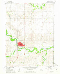
The village of Bruning serves as a central hub for the surrounding plains, situated at the intersection of the Chicago Burlington And Quincy railroad and the county line between Fillmore and Thayer counties. In the southern portion of the map, the Belvidere settlement sits along the Union Pacific line near the banks of Big Sandy Creek. This 1960 survey illustrates a landscape dominated by township-and-range surveying, where farmsteads are connected by a regular grid of roads. Local genealogical interest is found at Keim Cem, tucked between the drainage of Dry Sandy Creek and the western township borders. The map captures an era of settled agriculture and rail-dependent commerce before the significant consolidation of rural infrastructure.
Find a feature on this map
13 named features on this map. Tap any name to fly to it.
Don’t see what you’re looking for? This feature index may not catch every label — zoom into the map to look around manually.
Map Details
Editions of this 1960 Bruning Map
This is the sole edition of this map. No revisions or reprints were ever made.
Other maps of this area

1898 · Hebron
USGS Topo · 1:125,000

1955 · Lincoln
USGS Topo · 1:250,000

1957 · Lincoln
USGS Topo · 1:250,000

1958 · Lincoln
USGS Topo · 1:250,000

1960 · Carleton
USGS Topo · 1:24,000

1960 · Tobias SW
USGS Topo · 1:24,000

1960 · Alexandria
USGS Topo · 1:24,000
1960 · Hebron
USGS Topo · 1:24,000
1960 · Deshler
USGS Topo · 1:24,000
1961 · Ohiowa
USGS Topo · 1:24,000