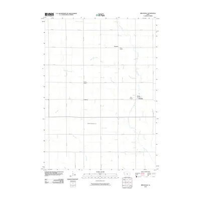
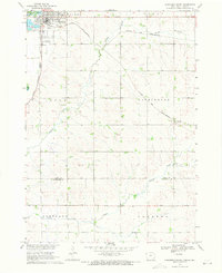
2010 Map of Brunsville
USGS Topo · Published 2010About this map
Brunsville serves as the primary hub in this corner of Plymouth County, shown here in the early 21st century as a stable agricultural community. The town center is defined by the Brunsville Post Office and nearby Saint Peters Cemetery, while the broader township retains its traditional rural layout. Evidence of the area's early settlement is preserved in its religious and family landmarks, such as Mammen to the north and the isolated Plymouth Presbyterian Cemetery near the center of the sheet. The landscape is drained by several small watercourses including Mink Creek, Broken Kettle Creek, and the uniquely named Bull Run. This topographic record also documents modern water management features like the Tekamah Creek Dam 41-A situated south of Crathorne, reflecting the ongoing agricultural engineering of the Iowa plains.
Find a feature on this map
29 named features on this map. Tap any name to fly to it.
Don’t see what you’re looking for? This feature index may not catch every label — zoom into the map to look around manually.
Map Details
Editions of this 2010 Brunsville Map
This is the sole edition of this map. No revisions or reprints were ever made.
Other maps of this area

1955 · Sioux City
USGS Topo · 1:250,000

1958 · Sioux City
USGS Topo · 1:250,000

1959 · Sioux City
USGS Topo · 1:250,000

1962 · Le Mars
USGS Topo · 1:62,500

1962 · Union Center
USGS Topo · 1:62,500

1964 · Hinton
USGS Topo · 1:24,000
1964 · Millnerville
USGS Topo · 1:24,000
1969 · Ireton
USGS Topo · 1:24,000
1969 · Brunsville
USGS Topo · 1:24,000
1969 · Hawarden South
USGS Topo · 1:24,000