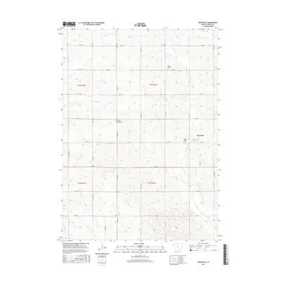
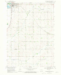
2015 Map of Brunsville
USGS Topo · Published 2015About this map
Brunsville serves as the primary community anchor in this portion of Plymouth County, situated at the intersection of Jet Rd and several local section-line corridors. The landscape is defined by the headwaters and drainage patterns of Mink Cr and Broken-Kettle Cr, which carve through the agricultural terrain. For genealogists and local historians, the presence of several established burial grounds provides significant research value, including the Christ Lutheran Cem near Co Rd C16 and the Plymouth Presbyterian Cem further south. These religious landmarks, along with Saint Peters Cem, reflect the ethnic and denominational settling patterns of the region. The map also illustrates the early paths of Bull Run and Perry Cr, tracing the natural hydrology that influenced the layout of early homesteads and township roads like 180th St and Co Hwy K30.
Find a feature on this map
24 named features on this map. Tap any name to fly to it.
Don’t see what you’re looking for? This feature index may not catch every label — zoom into the map to look around manually.
Map Details
Editions of this 2015 Brunsville Map
This is the sole edition of this map. No revisions or reprints were ever made.
Other maps of this area

1955 · Sioux City
USGS Topo · 1:250,000

1958 · Sioux City
USGS Topo · 1:250,000

1959 · Sioux City
USGS Topo · 1:250,000

1962 · Le Mars
USGS Topo · 1:62,500

1962 · Union Center
USGS Topo · 1:62,500

1964 · Hinton
USGS Topo · 1:24,000
1964 · Millnerville
USGS Topo · 1:24,000
1969 · Ireton
USGS Topo · 1:24,000
1969 · Brunsville
USGS Topo · 1:24,000
1969 · Hawarden South
USGS Topo · 1:24,000