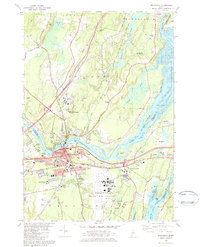
1980 Map of Brunswick
USGS Topo · Published 1984About this map
Brunswick and Topsham serve as the focal points of this 1980s landscape, situated at the confluence of the Androscoggin River and the Cathance River. The era is defined by the massive footprint of the Brunswick Naval Air Station and Brunswick NAS, which dominates the southern and eastern geography. To the north, the terrain transitions into the tidal flats of Merrymeeting Bay, where the Muddy River and Cathance River meet. Cultural and institutional life is anchored by Bowdoin College, while the historic industrial and transit roots of the region are evidenced by the Maine Central railroad lines and several scattered quarries. Local genealogists will find an unusually high concentration of burial grounds, including Pines Cem, Varney Cem, and the First Parish Cem, alongside smaller family plots like Rogers Cem.
Find a feature on this map
72 named features on this map. Tap any name to fly to it.
Don’t see what you’re looking for? This feature index may not catch every label — zoom into the map to look around manually.
Map Details
Editions of this 1980 Brunswick Map
3 editions found
Other maps of this area

1892 · Gardiner
USGS Topo · 1:62,500

1892 · Freeport
USGS Topo · 1:62,500

1894 · Bath
USGS Topo · 1:62,500

1908 · Lewiston
USGS Topo · 1:62,500

1920 · Bath
USGS Topo · 1:62,500

1941 · Freeport
USGS Topo · 1:62,500

1942 · Lewiston
USGS Topo · 1:62,500

1943 · Gardiner
USGS Topo · 1:62,500

1944 · Freeport
USGS Topo · 1:62,500

1945 · Bath
USGS Topo · 1:62,500