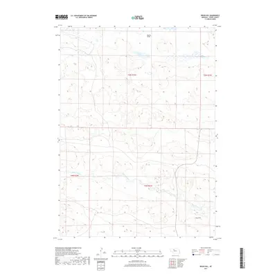
2017 Map of Brush Hill
USGS Topo · Published 2017About this map
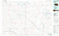
North Loup River meanders across the southern portion of this landscape, a vital water source in the high sandhills of Cherry County. The terrain is defined by the unique topography of Nebraska's Sandhills, characterized by numerous depressions and rises such as Brush Hill. To the north, Green Lake sits within a wide drainage basin, flanked by the broad expanse of Big Dry Valley. This 2017 survey shows a region largely defined by its natural hydrology and the Public Land Survey System divisions, with township lines like t28n r32w and t29n r32w marking the administrative layout of this ranching country. The absence of dense infrastructure highlights the remote, pastoral character of the land as it appeared in the early 21st century.
Find a feature on this map
8 named features on this map. Tap any name to fly to it.
Don’t see what you’re looking for? This feature index may not catch every label — zoom into the map to look around manually.
Map Details
Editions of this 2017 Brush Hill Map
This is the sole edition of this map. No revisions or reprints were ever made.
Other maps of this area
1949 · Big Falls
USGS Topo · 1:62,500
1950 · Powderhorn Valley
USGS Topo · 1:62,500
1950 · Kennedy
USGS Topo · 1:62,500
1951 · Big Falls
USGS Topo · 1:62,500
1951 · Bull Lake
USGS Topo · 1:62,500

1957 · Valentine
USGS Topo · 1:250,000

1959 · Valentine
USGS Topo · 1:250,000
1985 · Powderhorn Valley SW
USGS Topo · 1:24,000
1985 · Mullen
USGS Topo · 1:100,000
1985 · Goose Creek
USGS Topo · 1:100,000