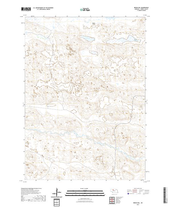
2021 Map of Brush Hill
USGS Topo · Published 2021About this map
North Loup River winds through the southern reaches of this Sandhills landscape, creating a distinct riparian corridor amidst the surrounding topography. The terrain is characterized by the intricate drainage patterns of the Big Dry Valley in the north and the isolated waters of Green Lake. This 2021 survey, based on 2020 imagery, documents the rural character of Cherry County, Nebraska, where land use is primarily defined by large-scale ranching and open space. The map detail highlights the relationship between the seasonal water sources and the vast, undulating land forms of the region, providing a modern record of this sparsely populated interior.
Find a feature on this map
7 named features on this map. Tap any name to fly to it.
Don’t see what you’re looking for? This feature index may not catch every label — zoom into the map to look around manually.
Map Details
Editions of this 2021 Brush Hill Map
This is the sole edition of this map. No revisions or reprints were ever made.
Other maps of this area

1949 · Big Falls
USGS Topo · 1:62,500

1950 · Powderhorn Valley
USGS Topo · 1:62,500

1950 · Kennedy
USGS Topo · 1:62,500

1951 · Big Falls
USGS Topo · 1:62,500

1951 · Bull Lake
USGS Topo · 1:62,500

1957 · Valentine
USGS Topo · 1:250,000

1959 · Valentine
USGS Topo · 1:250,000

1985 · Powderhorn Valley SW
USGS Topo · 1:24,000

1985 · Mullen
USGS Topo · 1:100,000

1985 · Goose Creek
USGS Topo · 1:100,000