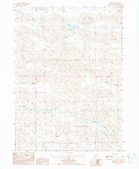
1987 Map of Brush Hill
USGS Topo · Published 1987About this map
Isolated ranchsteads and the winding course of the North Loup River define this portion of the Nebraska Sandhills during the late 1980s. The landscape is primarily shaped by natural depressions and rises, such as Big Dry Valley and the distinctive Brush Hill, reflecting the characteristic topography of Cherry County. Settlement is sparse and centered on established family operations, including the Boyer Ranch and the Clair Carpenter Ranch. These locations, along with Howarth Ranch and Sherman Ranch, illustrate the enduring cattle ranching heritage that has anchored this region for generations. The presence of Green Lake suggests a localized water source amidst the surrounding terrain, which is dominated by sections and townships surveyed under the Public Land Survey System.
Find a feature on this map
12 named features on this map. Tap any name to fly to it.
Don’t see what you’re looking for? This feature index may not catch every label — zoom into the map to look around manually.
Map Details
Editions of this 1987 Brush Hill Map
This is the sole edition of this map. No revisions or reprints were ever made.
Other maps of this area

1949 · Big Falls
USGS Topo · 1:62,500

1950 · Powderhorn Valley
USGS Topo · 1:62,500

1950 · Kennedy
USGS Topo · 1:62,500

1951 · Big Falls
USGS Topo · 1:62,500

1951 · Bull Lake
USGS Topo · 1:62,500

1957 · Valentine
USGS Topo · 1:250,000

1959 · Valentine
USGS Topo · 1:250,000

1985 · Powderhorn Valley SW
USGS Topo · 1:24,000

1985 · Mullen
USGS Topo · 1:100,000

1985 · Goose Creek
USGS Topo · 1:100,000