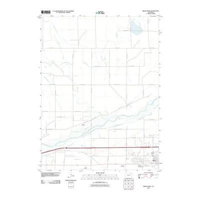
2010 Map of Brush West
USGS Topo · Published 2010About this map
The South Platte River corridor near Brush defines this High Plains landscape, where an intricate network of irrigation systems supported 21st-century agricultural life. The map details a complex hydraulic landscape featuring the Riverside Intake Canal, Tremont Canal, and the Lower Platte and Beaver Ditch, illustrating how water management has historically dictated settlement patterns in Morgan County. Small communities and siding locations like Dodd, Nelson, and Lodi are situated along the transit and water routes south of the river. Genealogists will find significant detail in the southeastern corner, which includes the J. L. Brush Memorial Cemetery, the Brush Cemetery, and the Eben-Ezer Lutheran Care Center Cemetery, providing a precise record of local heritage and burial sites in the Brush vicinity during this era.
Find a feature on this map
38 named features on this map. Tap any name to fly to it.
Don’t see what you’re looking for? This feature index may not catch every label — zoom into the map to look around manually.
Map Details
Editions of this 2010 Brush West Map
This is the sole edition of this map. No revisions or reprints were ever made.
Other maps of this area

1951 · Dead Horse Springs
USGS Topo · 1:24,000

1951 · Brush West
USGS Topo · 1:24,000

1951 · Antelope Springs
USGS Topo · 1:24,000

1951 · Brush East
USGS Topo · 1:24,000

1951 · Peace Valley School
USGS Topo · 1:24,000

1951 · Fort Morgan
USGS Topo · 1:24,000

1954 · Sterling
USGS Topo · 1:250,000

1958 · Sterling
USGS Topo · 1:250,000

1963 · Lamb
USGS Topo · 1:24,000

1963 · Round Top
USGS Topo · 1:24,000