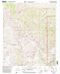
1999 Map of Brushy Mountain
USGS Topo · Published 2002About this map
Brushy Mountain dominates the high-elevation landscape of this 1999 revision, where the peaks of the Gila National Forest overlook the winding Gila River. This terrain is defined by its water sources and mining history, as evidenced by the numerous named springs and tanks that supported the region's livestock and extractive industries. The southeastern portion of the map reveals the concentrated mining activity near Telegraph Mountain, featuring the Telegraph Mine and several unnamed mine shafts and prospects.
Find a feature on this map
60 named features on this map. Tap any name to fly to it.
Don’t see what you’re looking for? This feature index may not catch every label — zoom into the map to look around manually.
Map Details
Editions of this 1999 Brushy Mountain Map
This is the sole edition of this map. No revisions or reprints were ever made.
Other maps of this area

1954 · Silver City
USGS Topo · 1:250,000

1958 · Silver City
USGS Topo · 1:250,000

1959 · Steeple Rock
USGS Topo · 1:62,500

1959 · Redrock
USGS Topo · 1:62,500

1959 · Canador Peak
USGS Topo · 1:62,500

1959 · Cliff
USGS Topo · 1:62,500

1962 · Silver City
USGS Topo · 1:250,000
1990 · Cliff
USGS Topo · 1:24,000
1990 · Bullard Peak
USGS Topo · 1:24,000
1990 · Antelope Ridge
USGS Topo · 1:24,000