
1959 Map of Cliff
USGS Topo · Published 1960About this map
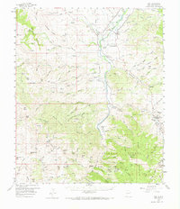
The Gila River corridor serves as the lifeblood of this Grant County landscape, where the small communities of Cliff and Gila sit at the confluence with Duck Creek. This 1959 field-checked survey reveals a rugged ranching and mining territory defined by the towering Big Burro Mountains and Gila Mountains. The map provides significant detail for genealogists, documenting family-named locations such as the Bradberry Ranch, Wallace Ranch, and Hap McCauley Ranch. Traditional rural infrastructure is evident through the inclusion of the Stout Cem and Clark Cem, alongside the Fairground near Redrock Basin. Economic activity of the era is marked by the Black Eagle Mine and Purple Heart Mine in the southern reaches, while an Old Trail and several jeep tracks suggest the difficult passage through the Gila National Forest before modern road networks were fully established.
Find a feature on this map
52 named features on this map. Tap any name to fly to it.
Don’t see what you’re looking for? This feature index may not catch every label — zoom into the map to look around manually.
Map Details
Editions of this 1959 Cliff Map
2 editions found
Other maps of this area

1909 · Silver City
USGS Topo · 1:125,000

1910 · Mogollon
USGS Topo · 1:125,000

1911 · Alum Mountain
USGS Topo · 1:125,000

1912 · Mogollon
USGS Topo · 1:125,000

1913 · Alum Mountain
USGS Topo · 1:125,000

1949 · Circle Mesa
USGS Topo · 1:24,000

1950 · Dorsey Ranch
USGS Topo · 1:24,000

1950 · Wind Mountain
USGS Topo · 1:24,000

1951 · Circle Mesa
USGS Topo · 1:24,000

1951 · Dorsey Ranch
USGS Topo · 1:24,000