
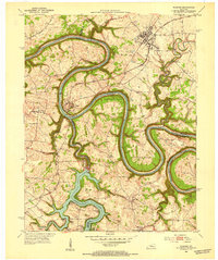
1950 Map of Bryantsville
USGS Topo · Published 1953About this map
The sinuous Dix River and the expansive Herrington Lake dominate this landscape where the boundaries of Garrard, Boyle, and Lincoln counties meet. Following a 1950 aerial survey, this map captures the region's complex geography of sharp river bends and high overlooks like Burdette Knob. In the southwest, a portion of the Wilderness Trail is documented, serving as a reminder of the area's deep roots in early American westward migration.
Find a feature on this map
36 named features on this map. Tap any name to fly to it.
Don’t see what you’re looking for? This feature index may not catch every label — zoom into the map to look around manually.
Map Details
Editions of this 1950 Bryantsville Map
This is the sole edition of this map. No revisions or reprints were ever made.
Other maps of this area

1905 · Harrodsburg
USGS Topo · 1:125,000

1952 · Little Hickman
USGS Topo · 1:24,000

1952 · Buckeye
USGS Topo · 1:24,000

1952 · Danville
USGS Topo · 1:24,000

1952 · Harrodsburg
USGS Topo · 1:24,000

1952 · Lancaster
USGS Topo · 1:24,000

1952 · Bryantsville
USGS Topo · 1:24,000

1952 · Stanford
USGS Topo · 1:24,000
1952 · Wilmore
USGS Topo · 1:24,000

1952 · Junction City
USGS Topo · 1:24,000