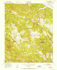
1949 Map of Bryson
USGS Topo · Published 1952About this map
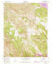
The Hunter Liggett Military Reservation dominates the northern reaches of this landscape, its approximate boundary marking a transition from wild terrain into the pastoral life of the Sapaque Valley. Centered around the small settlement of Bryson, the map reveals a remote ranching and farming community supported by local institutions like the Hesperia Sch and Pleyto Sch. The complex topography of the Santa Lucia Range is carved by the Nacimiento River and San Antonio River, where family-named landmarks such as Smith Ranch and Beasley Flat denote early homesteads. The southern portion of the sheet is punctuated by distinctive geographic markers like The Cantinas and Grizzly Bend, reflecting a period when the local economy was tied to these river corridors and the winding Pleyto-Copperhead Road long before modern development altered the region.
Find a feature on this map
28 named features on this map. Tap any name to fly to it.
Don’t see what you’re looking for? This feature index may not catch every label — zoom into the map to look around manually.
Map Details
Editions of this 1949 Bryson Map
6 editions found
Other maps of this area

1919 · Bryson
USGS Topo · 1:62,500

1919 · Bradley
USGS Topo · 1:62,500

1919 · Adelaida
USGS Topo · 1:62,500

1919 · San Simeon
USGS Topo · 1:62,500

1932 · Adelaida
USGS Topo · 1:62,500

1937 · San Simeon
USGS Topo · 1:62,500

1941 · Bradley
USGS Topo · 1:62,500

1941 · Bryson
USGS Topo · 1:62,500

1942 · Adelaida
USGS Topo · 1:62,500

1942 · Bryson
USGS Topo · 1:62,500