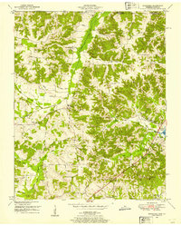
1950 Map of Buchanan
USGS Topo · Published 1953About this map
The borderlands of Calloway County and Henry County come into focus in this 1950 topographical survey, defined by a landscape transitioning from agricultural hill country to the newly formed shoreline of Kentucky Lake. The settlement at Buchanan serves as a local hub, while the surrounding terrain is marked by a dense network of family-named cemeteries and rural congregations such as Mt Sinai Ch and Blood River Ch. The hydraulic engineering of the era is evident in the Blood River Drainage Canal and the Holly Fork Drainage Canal Creek, reflecting efforts to manage the local waterways feeding into the Tennessee River system.
Find a feature on this map
55 named features on this map. Tap any name to fly to it.
Don’t see what you’re looking for? This feature index may not catch every label — zoom into the map to look around manually.
Map Details
Editions of this 1950 Buchanan Map
2 editions found
Other maps of this area

1936 · Poplar Creek
USGS Topo · 1:24,000

1936 · Conyersville
USGS Topo · 1:24,000

1936 · Buchanan
USGS Topo · 1:24,000

1936 · Hazel
USGS Topo · 1:24,000

1936 · New Concord
USGS Topo · 1:24,000

1936 · Hamlin
USGS Topo · 1:24,000

1936 · Centerville Landing
USGS Topo · 1:24,000

1936 · Paris
USGS Topo · 1:24,000

1936 · Springville
USGS Topo · 1:24,000

1938 · Springville
USGS Topo · 1:24,000