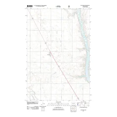
2011 Map of Buchanan
USGS Topo · Published 2011About this map
Buchanan serves as the central hub for this rural Stutsman County landscape, situated along the diagonal corridor of US Route 281. The town's grid is small but distinct, anchored by local thoroughfares such as Main St and Park St. This 2011 survey reveals a classic Great Plains agricultural pattern, where section roads like 25th St SE and 78th Ave SE divide the land into expansive parcels typical of North Dakota's farming heritage. To the east, the James River snakes through a wide valley, its riparian corridor providing a stark contrast to the surrounding upland prairie. In the southwest corner, the winding path of Pipestem Creek adds further hydrological detail to this segment of the Missouri River watershed, illustrating how water access shaped the early organization of the county.
Find a feature on this map
19 named features on this map. Tap any name to fly to it.
Don’t see what you’re looking for? This feature index may not catch every label — zoom into the map to look around manually.
Map Details
Editions of this 2011 Buchanan Map
This is the sole edition of this map. No revisions or reprints were ever made.
Other maps of this area

1896 · Jamestown
USGS Topo · 1:125,000

1900 · Pingree
USGS Topo · 1:125,000

1900 · Pingree
USGS Topo · 1:62,500

1950 · Buchanan
USGS Topo · 1:24,000

1950 · Fried
USGS Topo · 1:24,000

1951 · Jamestown
USGS Topo · 1:24,000

1951 · Fried
USGS Topo · 1:24,000

1951 · Pingree
USGS Topo · 1:24,000

1951 · Eldridge NW
USGS Topo · 1:24,000

1952 · Buchanan
USGS Topo · 1:24,000