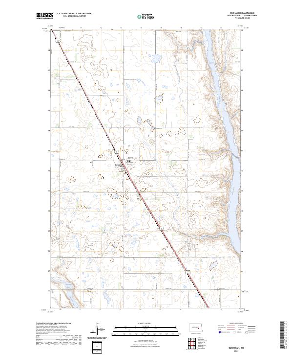
2024 Map of Buchanan
USGS Topo · Published 2024About this map
Buchanan serves as the focal point of this Stutsman County landscape, situated where the diagonal path of U.S. Route 281 intersects the grid of section lines. This rural corridor is defined by its agricultural layout and significant local landmarks, including both the Buchanan Cem and Saint Margaret Mary Cem located just east of the main settlement. The eastern edge of the quadrangle is dominated by the winding course of the James River, while the southwestern corner features the waters of Pipestem Lake and Pipestem Creek. This 2024 survey documents the enduring physical character of the North Dakota prairie, where the traditional township and range divisions—marked here by boundaries like t142n r64w and t141n r65w—continue to organize the land and its transport network.
Find a feature on this map
27 named features on this map. Tap any name to fly to it.
Don’t see what you’re looking for? This feature index may not catch every label — zoom into the map to look around manually.
Map Details
Editions of this 2024 Buchanan Map
This is the sole edition of this map. No revisions or reprints were ever made.
Other maps of this area

1896 · Jamestown
USGS Topo · 1:125,000

1900 · Pingree
USGS Topo · 1:125,000

1900 · Pingree
USGS Topo · 1:62,500

1950 · Buchanan
USGS Topo · 1:24,000

1950 · Fried
USGS Topo · 1:24,000

1951 · Jamestown
USGS Topo · 1:24,000

1951 · Fried
USGS Topo · 1:24,000

1951 · Pingree
USGS Topo · 1:24,000

1951 · Eldridge NW
USGS Topo · 1:24,000

1952 · Buchanan
USGS Topo · 1:24,000