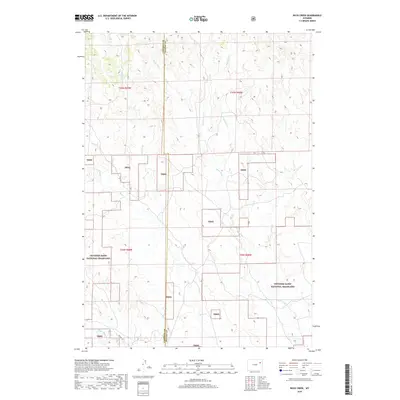
2018 Map of Buck Creek
USGS Topo · Published 2018About this map
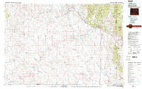
Thunder Basin National Grassland dominates this high plains landscape along the border of Campbell and Weston Counties. The terrain is defined by a complex drainage network feeding into Buck Creek, characterized by numerous named prongs and creeks that suggest the seasonal water movement essential for ranching in this arid environment. Significant watercourses including Black Thunder Creek, Bacon Creek, and Haley Prong carve through the grassland, providing natural landmarks across the open range. Modern infrastructure is sparse, with Keeline Rd serving as a primary corridor through the southern portion of the quadrangle. The map captures the specialized land management of the region, where public national grassland tracts are interspersed with private holdings, a pattern typical of eastern Wyoming's energy and livestock-producing regions in the early twenty-first century.
Find a feature on this map
17 named features on this map. Tap any name to fly to it.
Don’t see what you’re looking for? This feature index may not catch every label — zoom into the map to look around manually.
Map Details
Editions of this 2018 Buck Creek Map
This is the sole edition of this map. No revisions or reprints were ever made.
Other maps of this area

1955 · Newcastle
USGS Topo · 1:250,000

1958 · Newcastle
USGS Topo · 1:250,000
1971 · Piney Canyon NE
USGS Topo · 1:24,000
1971 · Open A Ranch
USGS Topo · 1:24,000
1971 · Rough Creek
USGS Topo · 1:24,000
1971 · Piney Canyon NW
USGS Topo · 1:24,000
1971 · Jim Creek
USGS Topo · 1:24,000
1971 · Buck Creek
USGS Topo · 1:24,000
1974 · Reno Junction
USGS Topo · 1:100,000
1979 · Newcastle
USGS Topo · 1:100,000