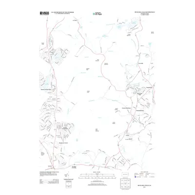
2013 Map of Buck Hill Falls
USGS Topo · Published 2013About this map
Buck Hill Falls and its surrounding peaks define this portion of the Pocono plateau in the early twenty-first century. The landscape is a dense mix of residential developments and natural landmarks, where suburban-style street networks like Pocono Country Place and Pocono Farms East sit adjacent to steep terrain like Seven Pines Mountain and Mount Godfrey. The map reveals a transition between established recreational hubs and newer residential expansion, evidenced by the presence of both the Pocono Playhouse and the Rocky Hill Ultralight Flightpark. Significant water features, including Taylor Cr, Rattlesnake Cr, and Buck Hill Cr, descend through the various knobs and mountains that characterize the region. Local centers of activity like Mountainhome, Canadensis, and Cresco are clearly marked, showing the concentration of commerce and community life along the primary road corridors that navigate the narrow valleys.
Find a feature on this map
237 named features on this map. Tap any name to fly to it.
Don’t see what you’re looking for? This feature index may not catch every label — zoom into the map to look around manually.
Map Details
Editions of this 2013 Buck Hill Falls Map
This is the sole edition of this map. No revisions or reprints were ever made.
Other maps of this area

1919 · Pocono
USGS Topo · 1:62,500

1921 · Pocono
USGS Topo · 1:62,500

1923 · Pocono
USGS Topo · 1:62,500

1924 · Bushkill
USGS Topo · 1:48,000

1928 · Ariel
USGS Topo · 1:62,500

1932 · Ariel
USGS Topo · 1:62,500

1935 · Hawley
USGS Topo · 1:62,500

1938 · Hawley
USGS Topo · 1:62,500

1943 · Bushkill
USGS Topo · 1:62,500

1943 · Pocono
USGS Topo · 1:62,500
Featured Places
- Greene Township, PA
- Barrett Township, PA
- Dreher Township, PA
- Lake in the Clouds West, Greene Township
- Buck Hill Falls, Mountainhome