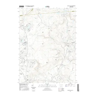
2016 Map of Buck Hill Falls
USGS Topo · Published 2016About this map
Buck Hill Falls serves as a prominent focal point in this portion of the Poconos, where the intersection of steep topography and numerous waterways has long shaped the region's development as a mountain retreat. The landscape is defined by a dense network of creeks including Brodhead Creek, Buck Hill Cr, and Griscom Cr which carve through the high ground of Seven Pines Mtn and Bush Mtn. This era shows significant residential density in planned communities like Pocono Country Place and the established resort character of Mountainhome and Canadensis. The map reveals the sophisticated infrastructure required to navigate this terrain, from the winding path of Preacher Hill Rd to the strategic positioning of the Pocono Mountains Municipal Airport on the relatively level ground near Mount Pocono. Natural landmarks such as The Devils Hole and Lake in the Clouds underscore the area's geological complexity and its enduring appeal for outdoor recreation.
Find a feature on this map
158 named features on this map. Tap any name to fly to it.
Don’t see what you’re looking for? This feature index may not catch every label — zoom into the map to look around manually.
Map Details
Editions of this 2016 Buck Hill Falls Map
This is the sole edition of this map. No revisions or reprints were ever made.
Other maps of this area

1919 · Pocono
USGS Topo · 1:62,500

1921 · Pocono
USGS Topo · 1:62,500

1923 · Pocono
USGS Topo · 1:62,500

1924 · Bushkill
USGS Topo · 1:48,000

1928 · Ariel
USGS Topo · 1:62,500

1932 · Ariel
USGS Topo · 1:62,500

1935 · Hawley
USGS Topo · 1:62,500

1938 · Hawley
USGS Topo · 1:62,500

1943 · Bushkill
USGS Topo · 1:62,500

1943 · Pocono
USGS Topo · 1:62,500
Featured Places
- Greene Township, PA
- Barrett Township, PA
- Dreher Township, PA
- Lake in the Clouds West, Greene Township
- Buck Hill Falls, Mountainhome