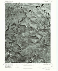
1976 Map of Buck Hill Falls
USGS Topo · Published 1978About this map
Mount Pocono and the surrounding Pocono Mountains landscape are captured in this 1976 orthophotograph, a specialized mapping format that blends aerial imagery with topographic accuracy. The photographic detail reveals the intricate development patterns of mid-century resort communities and residential enclaves, particularly around Buck Hill Falls and Mountainhome. Unlike traditional line maps, this survey provides a direct view of the dense forest cover and the winding road networks that connect Canadensis to the neighboring settlements. Genealogists and local historians can use the aerial perspective to identify specific building footprints, property clearings, and the early infrastructure of this established vacation region as it appeared before more modern expansions transformed the terrain.
Find a feature on this map
4 named features on this map. Tap any name to fly to it.
Don’t see what you’re looking for? This feature index may not catch every label — zoom into the map to look around manually.
Map Details
Editions of this 1976 Buck Hill Falls Map
This is the sole edition of this map. No revisions or reprints were ever made.
Other maps of this area

1919 · Pocono
USGS Topo · 1:62,500

1921 · Pocono
USGS Topo · 1:62,500

1923 · Pocono
USGS Topo · 1:62,500

1924 · Bushkill
USGS Topo · 1:48,000

1928 · Ariel
USGS Topo · 1:62,500

1932 · Ariel
USGS Topo · 1:62,500

1935 · Hawley
USGS Topo · 1:62,500

1938 · Hawley
USGS Topo · 1:62,500

1943 · Bushkill
USGS Topo · 1:62,500

1943 · Pocono
USGS Topo · 1:62,500
Featured Places
- Greene Township, PA
- Dreher Township, PA
- Paradise Township, PA
- La Anna, Greene Township
- Canadensis, Barrett Township