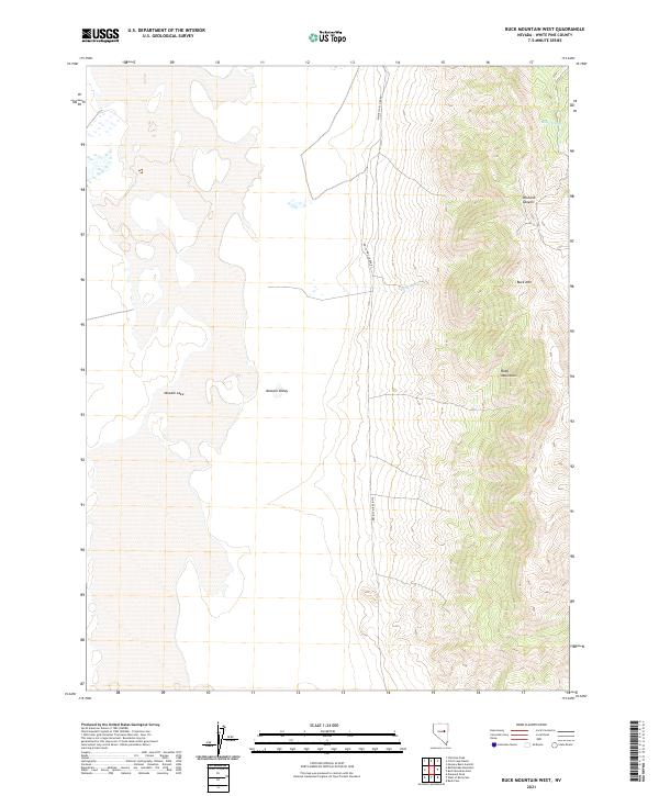
2021 Map of Buck Mountain West
USGS Topo · Published 2021About this map
The Ruby Mountains rise sharply above the floor of the Newark Valley on this western slope in White Pine County. The landscape is defined by the stark transition from high peaks, such as Buck Mtn, to the basin below where Newark Lake sits as a prominent desert feature. The drainage pattern is carved by seasonal or intermittent water sources like Deadman Cr and Moore Springs, which cut through the high-elevation terrain of Orchard Canyon. This high-desert environment shows very little modern development, with White Pine Co Road 1 serving as the primary corridor for traversing the valley floor. The map provides a clear record of the geological boundaries and township lines, including t21n r56e, that structure this sparsely populated corner of the Great Basin.
Find a feature on this map
14 named features on this map. Tap any name to fly to it.
Don’t see what you’re looking for? This feature index may not catch every label — zoom into the map to look around manually.
Map Details
Editions of this 2021 Buck Mountain West Map
This is the sole edition of this map. No revisions or reprints were ever made.
Other maps of this area

1953 · Eureka
USGS Topo · 1:62,500

1956 · Ely
USGS Topo · 1:250,000

1957 · Buck Mountain
USGS Topo · 1:62,500

1957 · Diamond Springs
USGS Topo · 1:62,500

1957 · Cold Creek Ranch
USGS Topo · 1:62,500

1959 · Ely
USGS Topo · 1:250,000

1963 · Ely
USGS Topo · 1:250,000

1985 · Newark Lake
USGS Topo · 1:100,000
1990 · Buck Mountain East
USGS Topo · 1:24,000
1990 · Diamond Peak
USGS Topo · 1:24,000