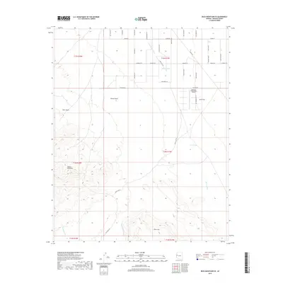
2018 Map of Buck Mountains SE
USGS Topo · Published 2018About this map
Sagebrush Trails Estates and its adjacent Airport sit at the intersection of modern settlement and the vast arid expanses of the Mohave Desert in Mohave County. This 2018 survey documents a region defined by complex drainage systems and varied terrain, where the peaks of the Mohave Mountains and the prominent Black Mtn overlook the broad alluvial surface of Dutch Flat. The local road network is a notable characteristic of this landscape, featuring numerous routes named after western figures and lore, such as Wild Bill Rd, Doc Holiday Rd, and Butch Cassidy Rd. These roads navigate the spaces between dry watercourses like Mohave Wash and Buck Mountain Wash, and past vital water management features such as Shot Up Tank and Lower Tank. To the west, the topography transitions into the steep relief of Deer Canyon, illustrating the shift from flat desert basins to the rugged interior of the mountain range.
Find a feature on this map
42 named features on this map. Tap any name to fly to it.
Don’t see what you’re looking for? This feature index may not catch every label — zoom into the map to look around manually.
Map Details
Editions of this 2018 Buck Mountains SE Map
This is the sole edition of this map. No revisions or reprints were ever made.
Other maps of this area

1911 · Parker
USGS Topo · 1:125,000

1923 · Signal
USGS Topo · 1:250,000

1927 · Buck Mountains
USGS Topo · 1:62,500

1929 · Buck Mountains
USGS Topo · 1:62,500

1942 · Signal
USGS Topo · 1:250,000

1943 · Giers Basin
USGS Topo · 1:62,500

1950 · Prescott
USGS Topo · 1:250,000

1954 · Needles
USGS Topo · 1:250,000

1954 · Prescott
USGS Topo · 1:250,000

1956 · Needles
USGS Topo · 1:250,000