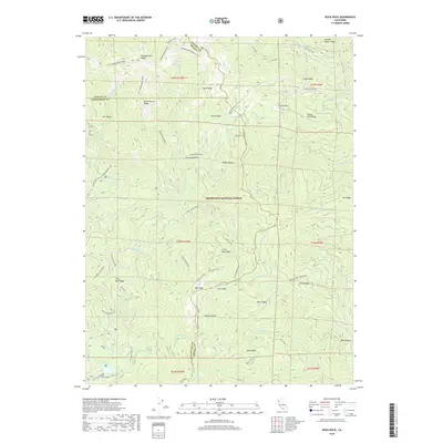
2018 Map of Buck Rock
USGS Topo · Published 2018About this map
Mendocino National Forest defines the geography of this high-elevation landscape where the borders of Tehama, Trinity, and Mendocino counties converge. The terrain is characterized by a series of prominent ridges, including Hammerhorn Ridge and Smokehouse Ridge, which descend toward deep drainages like Beaver Cr and Thomes Cr. Human activity in this wilderness is marked by isolated sites such as Howard Corral and Doll Camp, indicating a history of seasonal grazing or forestry. Small water bodies like Howard Lake and Hammerhorn Lake sit high in the timbered basins, while unique meadow clearings such as Irish Glade and Pony Meadows provide breaks in the heavy forest cover. The road network, including the Paskenta-Eel River route, traces the naturally occurring saddles and passes of the Coast Ranges.
Find a feature on this map
67 named features on this map. Tap any name to fly to it.
Don’t see what you’re looking for? This feature index may not catch every label — zoom into the map to look around manually.
Map Details
Editions of this 2018 Buck Rock Map
This is the sole edition of this map. No revisions or reprints were ever made.
Other maps of this area

1890 · Red Bluff
USGS Topo · 1:250,000

1894 · Red Bluff
USGS Topo · 1:250,000

1926 · Covelo
USGS Topo · 1:62,500

1931 · Hoaglin
USGS Topo · 1:96,000

1935 · Hoaglin
USGS Topo · 1:125,000

1952 · Covelo
USGS Topo · 1:62,500

1952 · Anthony Peak
USGS Topo · 1:62,500

1953 · Blackrock Mtn
USGS Topo · 1:62,500

1954 · Blackrock Mtn
USGS Topo · 1:62,500

1954 · Yolla Bolly
USGS Topo · 1:62,500