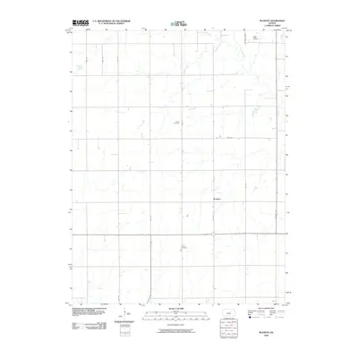
2009 Map of Buckeye
USGS Topo · Published 2009About this map
Buckeye anchors this rural Kansas landscape, situated in an area defined by a rhythmic grid of agricultural roads and the meandering path of Chapman Creek. This 2009 survey reflects the enduring layout of Dickinson County, where family and community history is preserved in several local burial grounds. Genealogists and researchers will find the locations of Green Ridge Cemetery in the north, Henry Cemetery near the center of the quadrangle, and Union Cemetery further south. The map documents the persistent infrastructure of the Great Plains, from the section-line roads like Flag Rd and Lark Road (1400) to the small settlement pockets that have served this farming region for generations.
Find a feature on this map
15 named features on this map. Tap any name to fly to it.
Don’t see what you’re looking for? This feature index may not catch every label — zoom into the map to look around manually.
Map Details
Editions of this 2009 Buckeye Map
This is the sole edition of this map. No revisions or reprints were ever made.
Other maps of this area

1889 · Abilene
USGS Topo · 1:125,000

1891 · Clay Center
USGS Topo · 1:125,000

1894 · Abilene
USGS Topo · 1:125,000

1955 · Manhattan
USGS Topo · 1:250,000

1955 · Hutchinson
USGS Topo · 1:250,000

1956 · Manhattan
USGS Topo · 1:250,000

1957 · Manhattan
USGS Topo · 1:250,000

1959 · Hutchinson
USGS Topo · 1:250,000
1963 · Upland
USGS Topo · 1:24,000
1963 · Solomon
USGS Topo · 1:24,000