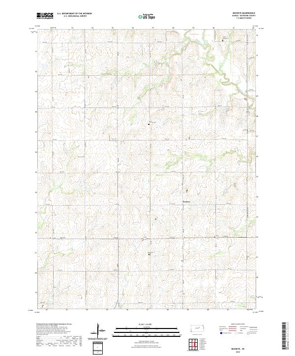
2022 Map of Buckeye
USGS Topo · Published 2022About this map
Buckeye sits at the heart of this Dickinson County landscape, where the Jeffersonian grid of the Public Land Survey System strictly dictates the placement of rural roads and property lines. The terrain is defined by the winding course of Chapman Cr in the northeast and a series of north-south thoroughfares including Key Rd (1300) and Lark Road (1400). The map reveals a deeply rooted agrarian community, evidenced by several well-preserved rural burial grounds that serve as focal points for local genealogy.
Find a feature on this map
67 named features on this map. Tap any name to fly to it.
Don’t see what you’re looking for? This feature index may not catch every label — zoom into the map to look around manually.
Map Details
Editions of this 2022 Buckeye Map
This is the sole edition of this map. No revisions or reprints were ever made.
Other maps of this area

1889 · Abilene
USGS Topo · 1:125,000

1891 · Clay Center
USGS Topo · 1:125,000

1894 · Abilene
USGS Topo · 1:125,000

1955 · Manhattan
USGS Topo · 1:250,000

1955 · Hutchinson
USGS Topo · 1:250,000

1956 · Manhattan
USGS Topo · 1:250,000

1957 · Manhattan
USGS Topo · 1:250,000

1959 · Hutchinson
USGS Topo · 1:250,000
1963 · Upland
USGS Topo · 1:24,000
1963 · Solomon
USGS Topo · 1:24,000