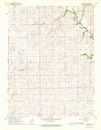
1964 Map of Buckeye
USGS Topo · Published 1965About this map
The agrarian landscape of northern Dickinson County is defined here by the winding course of Chapman Creek and the intersection of four historical townships: Cheever, Sherman, Buckeye, and Hayes. In the mid-1960s, the small settlement of Buckeye served as a focal point for the surrounding farmsteads, which are connected by a regular grid of section-line roads. This survey provides clear documentation for genealogists and local historians, mapping the precise locations of rural community centers like Bethany Ch and Zion Ch. The placement of Green Ridge Cem, Henry Cem, and Union Cem across the high ground reflects the early pioneer burial patterns of this Kansas prairie. The topography is marked by gentle drainage basins and small draws leading toward the main creek valley, illustrating the deep-rooted agricultural structure of the region during this era.
Find a feature on this map
11 named features on this map. Tap any name to fly to it.
Don’t see what you’re looking for? This feature index may not catch every label — zoom into the map to look around manually.
Map Details
Editions of this 1964 Buckeye Map
This is the sole edition of this map. No revisions or reprints were ever made.
Other maps of this area

1889 · Abilene
USGS Topo · 1:125,000

1891 · Clay Center
USGS Topo · 1:125,000

1894 · Abilene
USGS Topo · 1:125,000

1955 · Manhattan
USGS Topo · 1:250,000

1955 · Hutchinson
USGS Topo · 1:250,000

1956 · Manhattan
USGS Topo · 1:250,000

1957 · Manhattan
USGS Topo · 1:250,000

1959 · Hutchinson
USGS Topo · 1:250,000
1963 · Upland
USGS Topo · 1:24,000
1963 · Solomon
USGS Topo · 1:24,000