
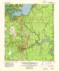
1941 Map of Buckeye
USGS Topo · Published 1944About this map
Catahoula Lake dominates the northern landscape of this survey, where the complex hydrology of Little River and numerous bayous meet the parishes of Rapides, La Salle, and Grant. The map documents a rural network of small communities and social centers during the early 1940s, anchored by places like Buckeye and Deville. Educational and spiritual life is well-recorded through locations such as Buckeye High School, Big Island School, and the Free Methodist Church.
Find a feature on this map
77 named features on this map. Tap any name to fly to it.
Don’t see what you’re looking for? This feature index may not catch every label — zoom into the map to look around manually.
Map Details
Editions of this 1941 Buckeye Map
2 editions found
Other maps of this area

1935 · Tooleys
USGS Topo · 1:62,500

1935 · Lecompte
USGS Topo · 1:62,500

1936 · Pollock
USGS Topo · 1:62,500

1940 · Marksville
USGS Topo · 1:62,500

1941 · Manifest
USGS Topo · 1:62,500

1941 · Jena
USGS Topo · 1:62,500

1941 · Voorhies
USGS Topo · 1:62,500

1941 · Alexandria
USGS Topo · 1:62,500

1941 · Pollock
USGS Topo · 1:62,500

1941 · Tooleys
USGS Topo · 1:62,500