
1941 Map of Pollock
USGS Topo · Published 1944About this map
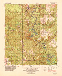
Little River and its intricate oxbows, including Round Lake and Woodward Lake, dominate this 1941 landscape of the central Louisiana piney woods. The river serves as the primary geographic divider between Grant Parish and La Salle Parish, while the Missouri Pacific RR and the Louisiana and Arkansas Railway provide the vital industrial backbone for the region's timber economy. At Selma, the confluence of rail lines and the river underscores the importance of transportation in the early 20th century.
Find a feature on this map
64 named features on this map. Tap any name to fly to it.
Don’t see what you’re looking for? This feature index may not catch every label — zoom into the map to look around manually.
Map Details
Editions of this 1941 Pollock Map
2 editions found
Other maps of this area

1932 · Colfax NE
USGS Topo · 1:31,680

1932 · Boyce NE
USGS Topo · 1:31,680

1932 · Colfax SE
USGS Topo · 1:31,680

1936 · Colfax
USGS Topo · 1:62,500

1936 · Pollock
USGS Topo · 1:62,500

1941 · Jena
USGS Topo · 1:62,500

1941 · Alexandria
USGS Topo · 1:62,500

1941 · Buckeye
USGS Topo · 1:62,500

1941 · Boyce
USGS Topo · 1:62,500

1950 · Winnfield
USGS Topo · 1:62,500