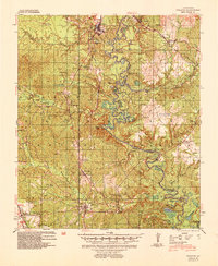
1941 Map of Pollock
USGS Topo · Published 1953About this map
Little River defines the central geography of this landscape, its winding course marked by oxbows like Horseshoe Lake and Hub Lake and multiple historic crossing points including Campbell Ferry and Peary Old Ferry. The rail-dominated economy of the early 1940s is evident in the corridors of the Missouri Pacific and the Louisiana And Arkansas Railway Company, which connect settlements such as Selma, Antonia, and Pollock. Much of the southern and western terrain falls within the Kistachie National Forest, where the U.S. Forestry Service was actively engaged in reforestation. Local genealogy is well-represented by family landmarks and rural institutions, from Thayer Sch and Friendship Ch to several small burial grounds like Stark Cem and Gwynes Cem. The map even identifies the head of navigation on the river, highlighting the transition from waterborne transit to the growing road network of Louisiana 30.
Find a feature on this map
73 named features on this map. Tap any name to fly to it.
Don’t see what you’re looking for? This feature index may not catch every label — zoom into the map to look around manually.
Map Details
Editions of this 1941 Pollock Map
2 editions found
Other maps of this area

1932 · Colfax NE
USGS Topo · 1:31,680

1932 · Boyce NE
USGS Topo · 1:31,680

1932 · Colfax SE
USGS Topo · 1:31,680

1936 · Colfax
USGS Topo · 1:62,500

1936 · Pollock
USGS Topo · 1:62,500

1941 · Jena
USGS Topo · 1:62,500

1941 · Alexandria
USGS Topo · 1:62,500

1941 · Buckeye
USGS Topo · 1:62,500

1941 · Pollock
USGS Topo · 1:62,500

1941 · Boyce
USGS Topo · 1:62,500