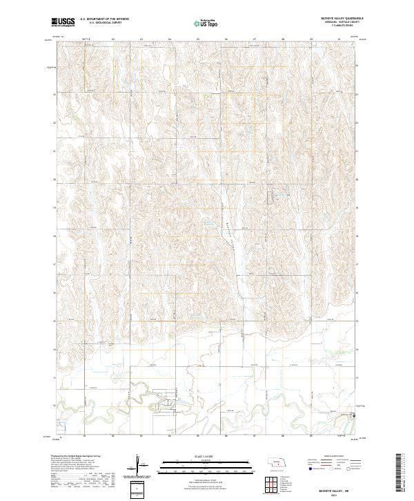
2021 Map of Buckeye Valley
USGS Topo · Published 2021About this map
Buckeye Valley defines the topography of this Buffalo County landscape, where the Wood River cuts through the southern reaches near the Riverside Cem. The map illustrates a highly organized section-line road network, including thoroughfares like Poole Ave and Ravenna RD, which connect the rural agricultural plots of the region. Water management is central to this area, evidenced by the presence of Randall Reservoir and Rogers Reservoir, alongside natural drainages like Cedar Cr and Sweet Cr. This modern survey by the U.S. Geological Survey details the contemporary rural infrastructure of central Nebraska, showing how the land is partitioned and accessed through a dense grid of numbered roads such as 100th Rd and Pole Line Rd.
Find a feature on this map
35 named features on this map. Tap any name to fly to it.
Don’t see what you’re looking for? This feature index may not catch every label — zoom into the map to look around manually.
Map Details
Editions of this 2021 Buckeye Valley Map
This is the sole edition of this map. No revisions or reprints were ever made.
Other maps of this area

1894 · Kearney
USGS Topo · 1:62,500

1894 · Minden
USGS Topo · 1:62,500

1896 · Kearney
USGS Topo · 1:125,000

1896 · Wood River
USGS Topo · 1:125,000

1955 · Grand Island
USGS Topo · 1:250,000

1957 · Grand Island
USGS Topo · 1:250,000

1958 · Grand Island
USGS Topo · 1:250,000

1962 · Newark
USGS Topo · 1:24,000
1962 · Poole NE
USGS Topo · 1:24,000
1962 · Pleasanton SE
USGS Topo · 1:24,000