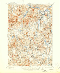
1913 Map of Buckfield
USGS Topo · Published 1947About this map
The Androscoggin River defines the upper northeast corner of this landscape, where the Maine Central RR Rangeley Division follows the river bend through Gilbertville and Canton. This era shows a densely settled rural economy organized around localized school districts and water-powered centers. Along the Nezinscot River, settlements like Buckfield and West Sumner thrive, while more specialized points such as Brettuns Mills Livermore PO and Mt Oxford Spring highlight the specific industrial and natural resources of the early twentieth century. Dozens of small schools, including the Meadowview Academy Hill and the Prince School, are scattered among the peaks of Black Mountain and Trask Mtn, marking a period when educational and social life was deeply decentralized and tied to these specific upland neighborhoods.
Find a feature on this map
144 named features on this map. Tap any name to fly to it.
Don’t see what you’re looking for? This feature index may not catch every label — zoom into the map to look around manually.
Map Details
Editions of this 1913 Buckfield Map
5 editions found
Other maps of this area

1896 · Norway
USGS Topo · 1:62,500

1908 · Poland
USGS Topo · 1:62,500

1908 · Lewiston
USGS Topo · 1:62,500

1910 · Livermore
USGS Topo · 1:62,500

1911 · Bryant Pond
USGS Topo · 1:62,500

1911 · Buckfield
USGS Topo · 1:62,500

1912 · Livermore
USGS Topo · 1:62,500

1913 · Buckfield
USGS Topo · 1:62,500

1914 · Bryant Pond
USGS Topo · 1:62,500

1924 · Farmington
USGS Topo · 1:62,500