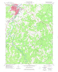
1977 Map of Buckhannon
USGS Topo · Published 1977About this map
West Virginia Wesleyan College and the red-tinted urban core of Buckhannon anchor this late-1970s survey of the Tygart Valley River watershed. The town's civic infrastructure is meticulously detailed, from the St Josephs Hospital and Courthouse to the Filtration Plant and local Armory. Beyond the municipal limits, the landscape transitions into a mix of active industry and rural communities. The path of the Baltimore and Ohio railroad follows the winding course of the Buckhannon River, passing through the settlements of Tennerton and Sago.
Find a feature on this map
77 named features on this map. Tap any name to fly to it.
Don’t see what you’re looking for? This feature index may not catch every label — zoom into the map to look around manually.
Map Details
Editions of this 1977 Buckhannon Map
This is the sole edition of this map. No revisions or reprints were ever made.
Other maps of this area

1893 · Buckhannon
USGS Topo · 1:125,000

1896 · Buckhannon
USGS Topo · 1:125,000

1897 · Buckhannon
USGS Topo · 1:125,000

1904 · Philippi
USGS Topo · 1:62,500

1904 · Weston
USGS Topo · 1:62,500

1912 · Sago
USGS Topo · 1:48,000

1912 · Crawford
USGS Topo · 1:48,000

1914 · Sago
USGS Topo · 1:62,500

1914 · Crawford
USGS Topo · 1:62,500

1925 · Philippi
USGS Topo · 1:62,500